GRSS Chapters
Chapter Resources
Chapter Resources This page contains resources to help with many aspects of running a local chapter. Viewgraphs from IGARSS-2016 Chapter Chairs Session During IGARSS-2016 there was a special session with
Start a Chapter
How to set up a Chapter The procedure to establish a new Chapter requires four steps. First of all, one needs to find at least 12 GRSS members “in good
Find a Chapter Near You
Find a Chapter near you and get in touch with your chapter chair.
GRSS Chapters
About Chapters Chapters represent GRSS at the regional level and provide an easy way for GRSS members to become involved in geoscience and remote sensing activities locally. Besides, they offer
Groups & Initiatives
Global Activities
GRSS activities are global in nature – solving science problems at global scales, developing instruments with global coverage, and coordinating ground truth collections on all continents, to name a few.
The Inspire, Develop, Empower, Advance (IDEA) Program
Our Mission The IDEA Program shall Inspire, Develop, Empower, and Advance (IDEA) all GRSS members and affiliates of accredited societies who are interested in the fields of interest of the
Van Allen Foundation + IEEE GRSS: Call for Ideas
The van Allen Foundation of the Université de Montpellier, France, and IEEE GRSS invite public and private organizations to propose ideas and suggestions aimed at addressing the issue of detection and tracking of marine pollution and litter in the western part of the Mediterranean Sea, including the Gulf of Lion, the Ligurian Sea, and the Balearic Sea.
Young Professionals (YP) in Geoscience and Remote Sensing
IEEE Young Professionals is a group of IEEE members and volunteers who have graduated from their first professional degree within the past 15 years. It is an international community, whose members are interested in elevating their professional image, expanding their global network, connecting with peers locally, and giving back to their community. Since it encompasses all members from recent university graduates to experienced professionals and entrepreneurs, the group is highly diverse in what it has to offer.
Distinguished Lecturers
Distinguished Lecturers
Distinguished Lecturers and Industry Speakers Program The GRSS Distinguished Lecturers and Industry Speakers Program is a service of the GRSS and its members to support our chapter activities. Our goal
How to Book a Speaker
How to Book a Speaker Requests for a lecture by one of the Distinguished Speakers is initiated by the local chapter with approval by the GRSS. The chapter contacts the
Technical Committees
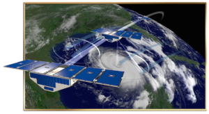

Global Navigation Satellite System Reflectometry Data and Metadata Content Working Group (P4003)
Global Navigation Satellite System Reflectometry Data and Metadata Content Working Group (P4003) Sponsoring Society and Committee: IEEE Geoscience and Remote Sensing Society/Standards Committee (GRSS/SC) Title: Standard for Global Navigation Satellite System-Reflectometry (GNSS-R)


Synthetic Aperture Radar Metadata Content Working Group (P4002)
Synthetic Aperture Radar Metadata Content Working Group (P4002) Title: Working Group for Synthetic Aperture Radar Metadata Content Standard Sponsor: Geoscience and Remote Sensing Society Standards Committee (GRSS-SC) Scope: The scope of this standard

Characterization and Calibration of Hyperspectral Imaging Devices Working Group (P4001)
Characterization and Calibration of Hyperspectral Imaging Devices Working Group (P4001) Title: Standard for Characterization and Calibration of Ultraviolet through Shortwave Infrared (250 nm to 2500 nm) Hyperspectral Imaging Devices Scope: This

Remote sensing Environment, Analysis and Climate Technologies
The Remote sensing Environment, Analysis and Climate Technologies Technical Committee (REACT TC) is a venue for all scientists and engineers in the domain of environment and the impact on the environment due to climate change forcing in order to exchange ideas and share knowledge.

High-performance and Disruptive Computing in Remote Sensing (HDCRS)
High-performance and Disruptive Computing in Remote Sensing (HDCRS) The mission of HDCRS The HDCRS working group is part of the IEEE GRSS Earth Science Informatics (ESI) Technical Committee. The main

WG on Benchmarking (WG-BEN)
WG-BEN Datasets have always been important in methodical remote sensing. They have always been used as a backbone for the development and evaluation of new algorithms. In today’s era of


